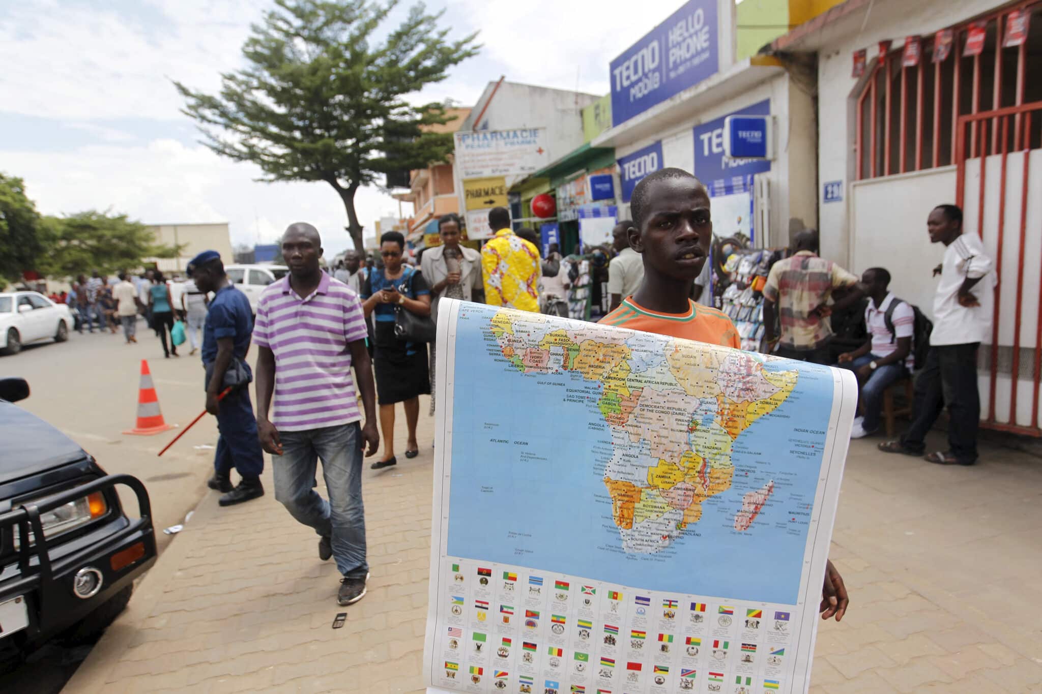
For centuries, maps have shaped the way people understand geography, history, and even global power dynamics. Yet the image most of the world still relies on, the Mercator projection, has long been criticized for distorting the size of continents. Africa, in particular, often appears smaller than it really is, overshadowed visually by Europe and North America despite being significantly larger in landmass. In a move that highlights the importance of representation in education and policy, the African Union has called for the adoption of maps that depict the continent at its actual scale.
The discussion about Africa’s depiction on international maps isn’t recent, yet it has become more urgent as the continent aims to claim its deserved position in international matters. On the Mercator map, Africa looks smaller, whereas regions such as Greenland and Russia look overly large. In truth, Africa’s large scale can fit the United States, China, India, and a significant portion of Europe together. By advocating for maps that display these proportions correctly, the African Union aims to rectify misunderstandings that have existed for many years and have shaped perceptions of Africa’s economic and political status.
Cartography is not a neutral science. Every projection involves trade-offs between shape, size, and distance. The Mercator map, originally developed for navigation in the 16th century, prioritized accurate direction over proportional land representation. While it was revolutionary for maritime exploration, it became the standard for classrooms and textbooks, unintentionally reinforcing a distorted worldview. The African Union’s push for change underscores the power maps hold in shaping perspectives and how lingering distortions can perpetuate outdated hierarchies.
For African leaders, the adoption of accurate maps is about more than geography; it is about visibility, dignity, and influence. When children in schools grow up seeing a diminished version of their continent, it subtly communicates that Africa is less significant than other regions. This perception, however subconscious, can affect cultural confidence and global narratives. By normalizing maps that show Africa’s true size, educators and policymakers can foster a stronger sense of identity and highlight the continent’s immense natural and human resources.
The call for accurate maps also intersects with broader discussions of decolonizing knowledge. Just as literature, history, and art are being revisited to challenge Eurocentric perspectives, cartography is undergoing a similar reassessment. For decades, critics have argued that traditional projections perpetuate a worldview shaped by European priorities. The African Union’s stance echoes movements across the Global South that demand tools of knowledge reflect balance and fairness. Correcting the map is thus symbolic of correcting historical misrepresentations that continue to influence international relations today.
Practically speaking, adopting new map projections is not without challenges. The Gall-Peters projection, for example, is often cited as a fairer alternative because it maintains proportional land size. However, it distorts shapes, making continents look stretched or compressed. Other projections, such as Winkel Tripel or Robinson, offer compromises by reducing distortion of both size and shape. The African Union has not endorsed a single alternative, but it advocates for the use of projections that reflect Africa’s true landmass more accurately, especially in educational and diplomatic contexts.
The implications of this shift could be significant. In economics, visualizing Africa’s true scale emphasizes its potential as a hub of growth. The continent holds vast reserves of natural resources, a young and expanding population, and an increasing role in global trade. When presented at its actual size, Africa is not peripheral but central, commanding attention as a continent whose physical presence rivals or exceeds many of the world’s largest economies combined. This visual reframing can strengthen arguments for investment and international partnerships.
In international politics, map accuracy influences perception of power. The United Nations, for instance, relies on maps in negotiations, reports, and development planning. A map that understates Africa’s scale may subtly minimize the weight of its collective voice. With 55 member states, the African Union represents a substantial bloc in global governance. By pushing for cartographic accuracy, it reinforces its role not as a region seeking aid but as a continent deserving equal footing in shaping international policy.
The adaptation in education might be revolutionary. Many cohorts of learners globally have been taught to accept inaccurate maps as factual. In Africa, this has resulted in a history of minimal visibility in educational settings where the youth ought to be discovering the vast scale and rich variety of their region. Using textbooks and online platforms that integrate precise maps can alter how upcoming individuals perceive their identity and role on the planet. For learners beyond Africa, it could promote a deeper comprehension of worldwide equilibrium and reliance.
The initiative also aligns with technological innovation. Digital mapping platforms, including geographic information systems (GIS) and online tools like Google Earth, already allow viewers to explore the planet without the limitations of static projections. These resources reveal Africa’s true vastness in ways traditional classroom maps never did. By encouraging broader adoption of such tools, the African Union is tapping into technology to amplify its message and ensure accuracy becomes the norm rather than the exception.
Critics of the initiative sometimes argue that maps are symbolic, and real progress for Africa lies in addressing issues such as poverty, governance, and infrastructure. However, supporters counter that symbolism matters. Maps are foundational to how people imagine the world, and perceptions shape policy, trade, and cultural narratives. Misrepresentation at a geographic level reinforces deeper structural inequalities. Correcting the map does not solve every problem, but it contributes to reframing Africa’s image in a way that supports broader ambitions for equality and development.
Historically, Africa has often been misrepresented not just in maps but in how its history and contributions were documented. The push for accurate cartography complements efforts to reclaim narratives about African civilizations, innovations, and cultural heritage. It positions geography as part of a larger struggle for fairness in knowledge systems. By confronting distortions in something as fundamental as a world map, the African Union demonstrates its determination to reshape the continent’s image at every level, from education to diplomacy.
The call for map reform has already sparked international discussion. Some schools in Europe and North America have begun introducing alternative projections to highlight issues of bias in geography. Nonprofit organizations dedicated to global education have also voiced support for teaching students about the limitations of different projections. The African Union’s stance adds political weight to this movement, giving it legitimacy and urgency. If adopted widely, it could transform how future generations around the world conceptualize the continent.
The symbolism of Africa claiming its true size on the global map cannot be overstated. It challenges outdated assumptions and places the continent visually at the scale it has always occupied physically. For Africans, it reinforces pride and recognition of their home as vast, diverse, and central to humanity’s story. For the rest of the world, it serves as a reminder that perspectives shaped by history can—and must—be revisited in pursuit of accuracy and fairness.
The African Union emphasizes the need for a revision of maps, which goes beyond just adjusting geographical details. This initiative seeks to reshape the world’s perception of Africa and consequently alter Africa’s self-image. Often overlooked in global depictions, the continent now calls to be recognized for its vastness, resourcefulness, and influence. Adjusting maps is more than an intellectual task; it is a crucial move toward addressing disparities in global storytelling. As highlighted by the African Union, recognizing the actual situation is essential for creating a fairer future.


